Showing posts with label Inland Empire. Show all posts

Friday, December 4, 2015

15 Fun Facts About San Bernardino

WHERE "E" STREET MEETS MILL STREET - Driving along Interstate 10 at quick glance it appears to be just one of the many cities that make up the urban puzzle piece that is Southern California. Yet, as many longtime residents will tell you, San Bernardino is very much a city of its own that stands out in the Southern California suburban puzzle, aside from being one of the principle cities in the Inland Empire.
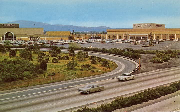
 photo ICMall1960s.jpg
A photograph of the Inland Center Mall circa 1969. Photograph used under a Creative Commons license.

If people in Southern California never quite were familiar with San Bernardino, well, they, along with much of the country, are now very much aware of this city called San Bernardino.
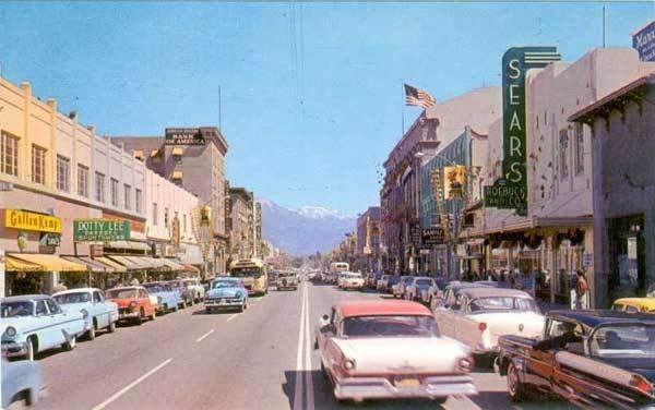
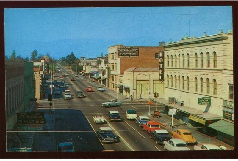
 photo 1950s-pc-sb-dt-3rd-001ac-600.jpg
Before Sears moved to the Inland Center Mall it was located in downtown San Bernardino as seen in this circa 1955 photograph. Photograph in public domain.

The Federal Bureau of Investigation uses certain criteria to formally declare a crime to be a "terrorist attack." It appears the recent event in San Bernardino is meeting that criteria set by the FBI. Subsequently, what occurred in San Bernardino on December 2, 2015, may end up being the deadliest terrorist attack within the United States since the terror attacks of September 11, 2001.

Given where the investigation of this mass shooting in San Bernardino, which killed 14 people and injured 21, has led, and where it is continuing to lead, this tragedy has not just national implications, but international implications.

Plenty of things have been written, from the San Bernardino Sun to The New York Times, about what occurred and what is continuing to transpire. We are not going to talk about that here. Since the world's eyes are on San Bernardino here are 15 fun facts about San Bernardino, San Bernardino County and the communities around San Bernardino.


The Mountain Goats singing about "San Bernardino."

1 - The First McDonald's Was In San Bernardino

That's right! The mother of fast food, giver of Happy Meals, with all the excitement and controversy that comes with it, began in San Bernardino.

2 - The Rolling Stones Played Their First U.S. Concert in San Bernardino
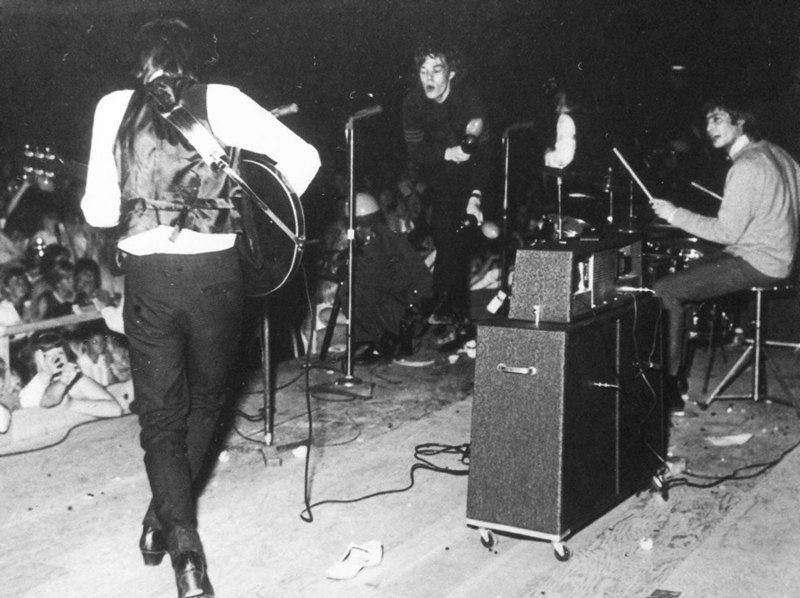
 photo 10363588_888135811203333_4984689997011917582_n_1.jpg
The Rolling Stones at The Swing Auditorium in San Bernardino. Photograph used under a Creative Commons license.

It was San Bernardino radio station K/MEN, back when radio was a really big deal, which brought The Rolling Stones for their very first U.S. performance at The Swing Auditorium in San Bernardino. How this radio station in San Bernardino brought them to the U.S. for the first time is a whole story in and of itself, which we will have in the not too distant future. The short story is, in the wake of The British Invasion K/MEN had a connection in London sending them the latest British hit-makers, and basically looking and hoping to find the next Beatles. Well, K/MEN's London connection sent them an album by "this group that is better than The Beatles," as their London connection described The Rolling Stones. Afternoon K/MEN personality Bill Watson played a cut from the album, suddenly the telephone lines were jammed, and "Mr. Kicks," as Bill Watson was known, did something extraordinarily out of the ordinary for top 40 radio and played the entire album.
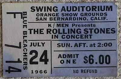
 photo RSSwing_1.jpg
Ticket from a later Rolling Stones performance at The Swing Auditorium. Photograph in public domain.

The Rolling Stones had made plans to tour the United States, but Mr. Watson knew they needed to get this band now! Mr. Watson, calling across The Atlantic, finally got in touch in The Rolling Stones' manager Andrew Loog Oldham. After some deals were cut, and told of the reaction of The Rolling Stones, Mick Jagger and company soon took to the U.S. stage for the very first time in San Bernardino thanks to K/MEN.

3 - Lyndon B. Johnson Had A Job As An Elevator Operator In San Bernardino
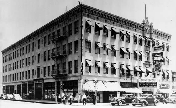
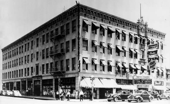
 photo PlattBldg_web_1.jpg
The Platt Building in San Bernardino where a future president once worked. Date of photograph unknown. Photograph in public domain.

Future Vice-President and President Lyndon B. Johnson once worked as an elevator operator at a San Bernardino building in 1925. During a 1964 reelection campaign stop in San Bernardino LBJ returned to that building, known as the Platt Building, to operate the elevator once more in front of a few cameras. The Platt Building fell in 1993 after meeting a demolition team under the names of "progress," "redevelopment" and "improvement." Many longtime residents were too happy with this new "improvement," which is to say it was a very conversational move demolishing the Platt Building. Before the Platt Building was torn down the elevator where LBJ worked was saved. 

4 - Home Of The Oldest Operating Jewish Cemetery 

The Home of Eternity Cemetery is the oldest operating Jewish cemetery in Southern California. The land was given to the Jewish community from Mormons in the 1850. 

5 - The Sun Almost Became Apart of the L.A. Times

The San Bernardino Sun has been for many decades, and continues to be, the dominate newspaper in the San Bernardino area (though in the last decade and a half it has faced stiff competition from The Press-Enterprise). Back in the 1960s the Los Angeles Times' then parent company Times-Mirror made an attempt to buy The Sun, but federal government antitrust officials were not too keen on the idea and thus no sale. Today The Sun is apart of the Los Angeles Newspaper Group, which includes, the L.A. Daily News, and Daily Bulletin, Pasadena Star-News, among other Southern California newspapers.

6 -  The Largest City Between L.A. and New Mexico Was Once, Colton

 photo Colton55.jpg
Certainly not Colton during the Californio era, but rather a photograph of downtown Colton from 1955. Public domain.

Near where current day Colton is there was once a town called Aqua Mansa, which was, for a time, the largest town between Los Angeles and New Mexico. It is a very significant place with its roots going back to Californio days. Its residents included the Wilson family and family member Don Benito Wilson. That Mr. Wilson is better known as Benjamin David Wilson who would go on to be the second elected Mayor of L.A., and whom Mount Wilson is named after. 

7 - What Does L.A.'s MacArthur Park Have To Do With Colton?

The writer of perhaps one of the most perplexing pop songs, "MacArthur Park," made famous twice, first by Richard Harris and later as a disco hit by Donna Summer, lived in the Colton area for a time once upon a time, and his name is Jimmy Webb. Mr. Webb also wrote "Up, Up and Away" as performed by The Fifth Dimension, along with many other songs. Mr. Webb even wrote a song about Colton, "820 Latham Street," perform by The Fifth Dimension (who had many rehearsal sessions in Colton) and The Brooklyn Bridge, which is apparently the Colton address where the girl of his dreams (and muse of many songs) lived. Turns out the girl of Mr. Webb's dream from Colton soon moved to L.A. and worked near MacArthur Park, which is where Mr. Webb and the girl from "820 Latham Street" in Colton spent many afternoons together. MacArthur Park ended up being a very special place for Mr. Webb and his girlfriend from Colton, and so he wrote a (long) song about it.


The Fifth Dimension singing about that girl who lives at "820 Latham Street" in Colton.

8 - Colton's First Marshall 

Virgil Earp, brother of Wyatt Earp, was Colton's first Marshall. The Earp house still stands at 528 West “H” Street in Colton. Please do not disturb the current residents.

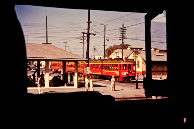
 photo NS-RTM-PE-1217-Colton-SP-undated-1024x683.jpg
This is a photograph of a Pacific Electric train station in Colton taken long after Virgil Earp was Marshall of Colton. Used under a Creative Commons license.

9 - Home Of The Cursed Fair

 photo NOS1917.jpg
Poster for the 1917 National Orange Show. Author's collection.

Most people who grew up or lived in San Bernardino or the Inland Empire for a time will tell you about the "Curse of the Orange Show." Southern California was a citrus empire, and the annual National Orange Show in San Bernardino was a prominent event showcasing the best of the citrus industry. In its glory days "The Orange Show," as so many locals lovingly call it, featured not just A-list stars, but the very top of A-list stars. It was a very glamorous affair, but it always seem to rain on their parade, and many residents say there is a reason for that. Legend has it The National Orange Show Grounds are built atop of a Native American burial ground. The legend goes since it was built atop of Native American burial grounds a curse was placed on the event that makes it rains every time The National Orange Show is held. Records show that in fact, yes, many times during The National Orange Show it has rained. Coincidence?

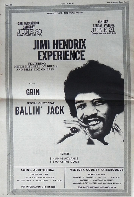
 photo 20150507-194808-574441.jpg.png
A 1969 ad in the Los Angeles Free Press for The Jimi Hendrix Experience at The Swing Auditorium. Public domain.

(By the way, The Swing Auditorium, where The Rolling Stones played their first U.S. concert as mentioned above, and, also where many bands came through in the 1960s and 1970s, was located on The National Orange Show Grounds. The Swing Auditorium was destroyed by an airplane crash on September 11, 1981.)

10 - San Bernardino Is Bigger Than Switzerland

If you are a regular driver between Southern California and Las Vegas you probably think San Bernardino County is a very large county. You would be right, because that county in the Inland Empire is the largest county within the lower 48 states. San Bernardino County is larger than many states and even many countries. It is bigger than Switzerland. Its record was beat with the admission of Alaska as a state, which has a much larger county.

11 - The Last Two Big California Earthquakes Were In San Bernardino County

The last two magnitude 7-plus earthquakes within California were in San Bernardino County. Those quakes were, the 1992 Landers Earthquake and the 1999 Hector Mine Earthquake.

12 - Home Of The Tallest Mountain Peak In Southern California

Many people really do not like earthquakes, and that is very understandable, but earthquake faults give us in Southern California spectacular hills and mountains. One of those mountains is Mount San Gorgonio. Located in San Bernardino County in the San Bernardino Mountains reaching a peak of 11,503 feet Mount San Gorgonio is the tallest mountain in Southern California. On a very clear day you can see Mount San Gorgonio from downtown Los Angeles and by the beach in Santa Monica.

13 - The 100th In The Nation

In covering the tragic event many reporters from around the country and around the world noted that San Bernardino is not quite a small city, and for good reason. According to the 2010 U.S. Census the 100th largest city in the U.S. is San Bernardino. As well, San Bernardino is the 17th largest city in California.

14 - Where Sammy Davis Jr. Lost His Eye

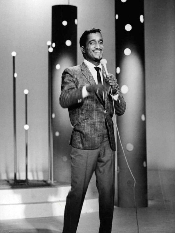
 photo Sammy_Davis_Jr._performing_1966.jpg
Sammy Davis Jr. performing on NBC in 1966. Photograph in public domain.

In 1954 on the way home to L.A. from performing in Las Vegas Sammy Davis Jr. was in a car accident on Route 66 at Cajon Boulevard and Kendall Drive. That is where Sammy Davis Jr. lost his eye. It would be at San Bernardino Community Hospital where Sammy Davis Jr. would recover. While at the hospital his friend, Eddie Cantor, met with him and talked about the similarities between Jewish and black culture. It was at that moment, so the story goes, Sammy would begin his conversion to Judaism. Sammy was so grateful for the services he received at San Bernardino Community Hospital he held an all-star fundraiser at The Swing Auditorium for the hospital.

15 - Home Of The Hell's Angels

Started by the Bishop family in Fontana the motorcycle club that would set the standard for "outlaw motorcycle clubs" and go on to much notoriety began in San Bernardino County.


Certainly not a tune by The Hell's Angels, but rather, a tune from Frank Zappa, who had a studio in Ontario.


Tuesday, June 2, 2015

When Local Radio Was A Big Deal

SAN BERNARDINO - Driving east on Baseline in San Bernardino onward to Highland you may notice three mid-size radio towers and an unassuming shack building behind San Gorgonio High School, and probably not think much of it. There is much more to the shack building than meets the eye, because that little building behind the high school actually has quite a bit of pop musically history behind it.

That little building once housed radio station KMEN on 1290 AM, and at its peak in the 1960s that radio station was a powerhouse. Many big names in pop music history, and radio history, came through that little building.

 photo KMEN1290.jpg
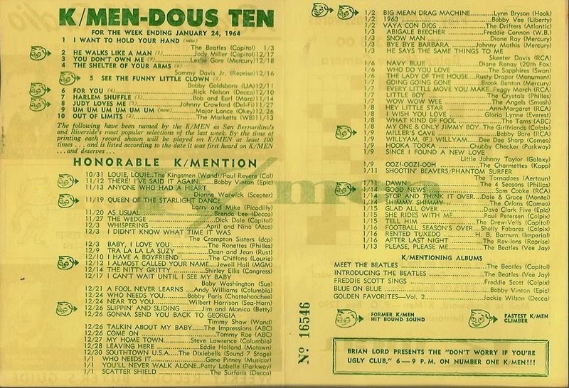
A "K/MEN-DOUS-TEN" Survey Sheet ending January 24, 1964, and of course The Beatles are number one.

Sometimes lost or buried in radio broadcast history with much focus on stations like, 93/KHJ, 1110/KRLA, 77/WABC or 89/WLS, KMEN never quite received its due in broadcast history.

Known as K/MEN 129 with its deejay personalities known as The K/MEN this radio station broadcasting out by a cow pasture was once a force in the radio and music industry.

In an era of YouTube, Pandora, Spotify, iTunes, Soundcloud and other forms of new media to check out new bands, for a younger generation it may be hard to imagine that radio was nearly the only place you can check out new bands. Even for new bands today, it may be hard to imagine the backing you needed from radio to have some sort of success. Back then, before the Internet, before cable television (if you can even imagine such a time), radio was one of the biggest forms of entertainment for kids, teens and adults. Bands back then did not have all these outlets to have their music heard, and bands knew radio was the place to go if you wanted to be heard.

Adding to bands wanting to be heard, competition from rival Inland Empire top 40 station 59/KFXM added to the sense of urgency on K/MEN's part to be the first in airing the newest bands.

Here are four things K/MEN 129 has in connection to music history.

1 - The Rolling Stones

 photo RSSwing_1.jpg
A 1966 ticket stub of The Rolling Stones' performance at The Swing Auditorium.

It was K/MEN that brought The Rolling Stones for their very first U.S. performance at The Swing Auditorium in San Bernardino. How this radio station in San Bernardino brought them to the U.S. for the first time is a whole story in and of itself, which we will have in the not too distant future. The short story is, in the wake of The British Invasion K/MEN had a connection in London sending them the latest British hit-makers, and basically looking and hoping to find the next Beatles. Well, K/MEN's London connection sent them an album by "this group that is better than The Beatles," as their London connection described The Rolling Stones. Afternoon K/MEN personality Bill Watson played a cut from the album, suddenly the telephone lines were jammed, and "Mr. Kicks," as Bill Watson was known, did something extraordinarily out of the ordinary for top 40 radio and played the entire album.

 photo 10363588_888135811203333_4984689997011917582_n_1.jpg
Mick Jagger on stage at The Swing Auditorium in San Bernardino doing his thing.

The Rolling Stones had made plans to tour the United States, but Mr. Watson knew they needed to get this band now! Mr. Watson, calling across The Atlantic, finally got in touch in The Rolling Stones' manager Andrew Loog Oldham. After some deals were cut, and told of the reaction of The Rolling Stones, Mick Jagger and company soon took to the U.S. stage for the very first time in San Bernardino thanks to K/MEN.

 photo 10390249_887457234604524_4762888443102419226_n_1.jpg
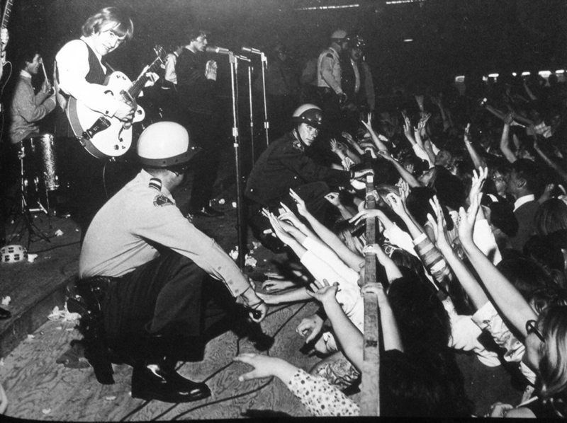
Those are San Bernardino Sheriff's deputies keeping the screaming girls back from "attacking" The Rolling Stones.

2 - The Beach Boys

Many singers, songwriters and bands came through the small lobby of K/MEN hoping their tune will make it on-the-air. Among these many hopeful bands who came through was a group of brothers from Hawthorne who called themselves, The Beach Boys. Mr. Watson, who, by the way, was the program direction, really liked this band and told them to get their music properly licensed and they will play it. Once the guys from Hawthorne got all the legal stuff taken care of it is believed K/MEN was the first to play The Beach Boys. In later years The Beach Boys replied in kind by singing jingles for K/MEN.

3 - Up, Up and Away with Jimmy Webb

Not too long ago we wrote about Colton, and one of its well known residents was singer/songwriter Jimmy Webb, who was certainly influenced by what K/MEN was playing. One of Mr. Webb's biggest hits he wrote was, "Up, Up and Away," performed by The Fifth Dimension (and sung by other performers over the years). Well, K/MEN once had its own hot-air balloon, and Mr. Webb thought it was a very nice looking thing, and so he wrote a song about it, and that tune became, "Up, Up and Away." In fact, the song was originally meant to be part of a K/MEN promotion. Apparently, the story goes, Mr. Webb wrote the song in just one afternoon sitting in his car at the Robert Hall Clothes store parking lot on La Cadena Drive and Mount Vernon Avenue in Colton (after sitting empty for many years a 99 Cent Only Store now occupies the old Robert Hall clothing store).


They may be a little out of sync in this video, but the tune written by Colton's Jimmy Webb and performed by The Fifth Dimension makes for pure top 40 AM gold.

4 - John Peel

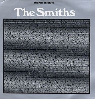
Before he began his legendary music show on BBC Radio 1 the man known as John Peel was across the pond here in the states hosting the morning show on K/MEN in 1965. Back then while in Inland Empire radio he was not known as John Peel, but rather he did something highly odd in radio, he used his real name on-air, John Ravenscroft. John Peel returned to England in 1967 and found a gig for a short time at Radio London aboard one of England's pirate radio ships (many of these England radio pirates were supported by U.S. record labels and had their radio jingles supplied by U.S. jingle makers). Mr. Peel would begin his BBC career later in 1967 and soon became a force in discovering and exposing England to underground, punk, new wave and alternative music. The Peel Sessions soon became, and still are, sought after albums.

 photo The_Peel_Sessions_-_The_Smiths.jpg
The Peel Sessions record with The Smiths. Used under Fair Use.


Saturday, May 30, 2015

Seven Random City Fun Facts: Colton

COLTON - Motoring rapidly along Interstate 10 perhaps on the way to Palm Springs for some sunshine and retro decor, or maybe you are driving all the way to the I-10's eastern terminus in Jacksonville, Florida, one of the many cities you come across is Colton. A fast glance at Colton shows no more than a typical Southern California suburb that is part of the puzzle piece making up the megalopolis that is the Los Angeles Basin.

 photo Colton55.jpg
The intersection of what is now Valley Boulevard and La Cadena Drive before the "development bomb" of the 1960s. Used under a Creative Commons license.

As is the case with many places across Southern California there is more to Colton than meets the eye. In fact, would you believe that Colton is connected to Mount Wilson, "MacArthur Park" and the Chicano movement. Sadly, as it also the case with many cities across Southern California, much of that has been erased in the name of progress.

The city, once called The Hub City, which is wedged between the cities of San Bernardino and Riverside, has an interesting background, and here are seven random fun facts about Colton.

1 - The writer of perhaps one of the most perplexing pop songs, "MacArthur Park," made famous twice, first by Richard Harris and later as a disco hit by Donna Summer, lived in the Colton area for a time once upon a time, and his name is Jimmy Webb. Mr. Webb also wrote "Up, Up and Away" as performed by The Fifth Dimension, along with many other songs. Mr. Webb even wrote a song about Colton, "820 Latham Street," perform by The Fifth Dimension and The Brooklyn Bridge, which is apparently the Colton address where the girl of his dreams (and muse of many songs) lived. Turns out the girl of Mr. Webb's dream from Colton soon moved to L.A. and worked near MacArthur Park, which is where Mr. Webb and the girl from "820 Latham Street" in Colton spent many afternoons together.


"820 Latham Street" as performed by The Fifth Dimension and written by Jimmy Webb.

2 - Once upon a time the community of Agua Mansa, now in modern day Colton and the name of a historic cemetery, was the largest town between Santa Fe and Los Angeles, and was a very important place in the Californio era. One Benjamin Davis Wilson, or Don Benito Wilson as he was known to the Native Americans, and who would go on to become mayor of L.A. and whom Mount Wilson is named after, had his life saved here by Lorenzo Trujillo after Mr. Wilson was involved violent battle with a Native American named Joaquin.

3 - Jimmy Webb was not the only musically famous person to come out of Colton. Jim Messina of Loggins and Messina and The Buffalo Springfield is also from Colton.

4 - Virgil Earp, brother of Wyatt Earp, was Colton's first Marshall. The Earp house still stands at 528 West “H” Street in Colton. Please do not disturb the current residents.

5 - Colton was created by promoters of the Southern Pacific Railroad (known in fiction as, The Octopus, by author Frank Norris), and the name Colton comes from, David Douty Colton, who was the vice president of Southern Pacific Railroad. Southern Pacific intended to make Colton the railroad center of Southern California. Mr. Colton probably made a couple trips to the city named after him, but he lived in San Francisco.

6 - The Chicano movement was, and still is, very strong in Colton. In fact, in clashes with police in 1943 there was even, sadly, a "Colton Zoot Suit Riot." This soon lead to a larger Chicano movement in Colton with protests against the police and demands for better services from the city. The protests were heard, and in the early 1950s a Chicano councilman was elected. By 1979 Colton elected a Chicano mayor and two Chicanos on the City Council, as well as a Chicano school board member. Colton was one of the first cities in Southern California to have such a strong representation of Chicanos in government.

7 - If you have driven through Colton in recent years, or really, for the past 20 years, you may notice it looks nothing like the photograph above. So what happened to Colton's downtown as shown in the photograph above? Well, the short answer is Colton made the decision (or mistake) many cities around the country made, and that was redevelopment. It is way too easy to say today that they should never have bulldozed their downtown, but remember when malls came in vogue that resulted in shoppers and businesses leaving city centers and downtown areas en mass for these new shiny, modern malls. The shoppers and businesses took their dollars with them to these new malls, and many cities, like Colton and even nearby San Bernardino, took the redevelopment route and basically wiped out their old downtown for what was suppose to be a new, modern shopping area that was going to bring business back. In Colton, and San Bernardino, it never quite worked and many long time residents regret the decisions their city leaders made. Some locals and former locals call it, "the development bomb."


Friday, March 6, 2015

Five Odd Southern California Earthquake Facts

HOLLYWOOD - Looking up Vine Street from Hollywood Boulevard the sudden rise of the street just above Yucca St. on the hill where The Hollywood Freeway lays atop shows the not so subtle signs of The Hollywood Fault, which has been in the news lately. Recent mapping by the California Geological Survey shows the fault is what helps give Hollywood and Los Feliz its character with its hills, and while the beauty is nice some developers are none too happy with this study.

When The Hollywood Fault, or any Southern California fault, will rupture with fury again is not clear as there are no accurate ways to predict earthquakes (not to be confused with forecasting earthquakes).

Walking over and along The Hollywood Fault on Los Feliz Blvd. one wonders about earthquakes past, and thus this piece is not about unhappy developers not getting their way, or even so much The Hollywood Fault, but rather five odd, peculiar Southern California earthquake facts.

 photo CAoverpass1971.jpg
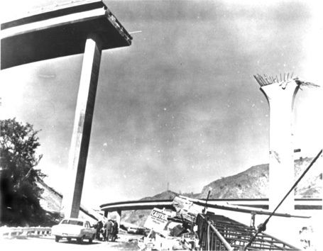
Severe freeway damage following the 1971 Sylmar Earthquake. Used under a Creative Commons license.

1 - The First Earthquake on Record

For thousands and thousands of years earthquakes, both very small and very large, have been happening in Southern California, as paleoseismology has proven, but while there were many animals and trees to feel the shaking as hills and mountains were being pushed up there were hardly many humans around. Any humans that were around never kept anything written about it, or hid their diary.

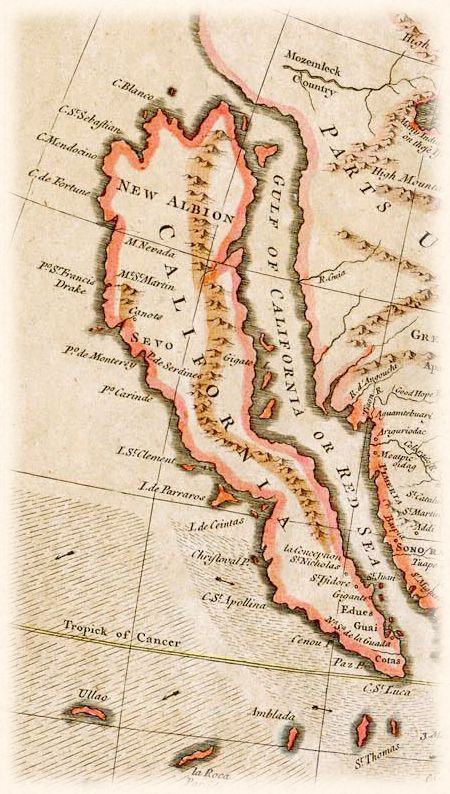
It would not be until 1769 that the first earthquake in Southern California would be recorded. Gaspar de Portola, Father Juan Crespí and a group of over 60 explorers from Spain, in the name to extend Spain's control up the Pacific Coast and establish colonies and missions (and hopefully prevent Russia and England from acquiring and taking this territory), set out from San Diego to Monterey on July 14, 1769. Maps at the time available to de Portola's group showed California extending from San Diego only to the Monterey Bay.

 photo Map_of_California_as_an_island_R.W._Seale_1745.jpg
When California was still thought of as an island in this 1745 map of California, and so not unusual to think de Portola's group thought the soon-to-be Golden State went as far as Monterey. Used under Creative Commons license.

After about a couple weeks of walking from San Diego to current day Orange County on July 28, 1769 and setting up camp at what is now The Santa Ana River in Anaheim de Portola's group felt a very large earthquake.

This earthquake occurred around 4 p.m., and the explorers recorded many aftershocks, several of them strong, as they made their way into the San Gabriel Valley. Records kept by de Portola's group show they stopped feeling any earthquakes when they were exiting the San Fernando Valley.

Among geologists, seismologists and historians there is much debate on just how big this earthquake was and just where the epicenter was located. Given the records by the de Portola team it was believed by many in the science and historic communities this earthquake was around magnitude 6.0 and probably on The San Jacinto Fault in the Inland Empire. Part of this was based on the diaries of the de Portola team saying they felt no more earthquakes once exiting the San Fernando Valley.

The United States Geological Survey (USGS) officially lists this earthquake, the very first earthquake in a long, forever growing list of Southern California earthquakes cataloged by the USGS, as M6.0 in the Los Angeles Basin. 

The when and where of this first recorded Southern California earthquake by the USGS has been challenged by University of California-Irvine geology professor Lisa Grant. Ms. Grant has proposed that the 1769 earthquake was actually M7.3 located on the relatively unknown San Joaquin Hills Fault located between Newport Beach and Laguna Beach, which resulted in the Orange County coastline being raised by almost 11 feet.


Put together by The Southern California Earthquake Center here is a scenario of a M6.7 earthquake on The San Joaquin Hills Fault.

The video above, combined with the diaries kept by the de Portola team, shows the theory by the UCI professor to be possible as strong shaking wanes in The San Fernando Valley. One thing the debate of the 1769 earthquake has brought up is the fact that Orange County has a major earthquake fault line that is not really well known, which has brought on more studies of the fault.

The when and where of this very first recorded Southern California earthquake still fascinates geologists and seismologists. Among other reasons, figuring out the mystery of this earthquake may help further understand and clarify the nature of earthquakes in Southern California (like the existence of a major earthquake fault in Orange County).

2 - Last Large Earthquake on Record

The last large earthquake in Southern California was a M7.9 in 1857, which is commonly called The Fort Tejon Earthquake. Not only was this the largest earthquake in Southern California recorded history, but this was one the largest earthquakes ever recorded in the United States.

This was also the last time The San Andreas Fault had a major rupture in Southern California. The infamous fault line is believed to have ruptured near Parkfield and continued rupturing south to just near The Cajon Pass. In fact, this was the last time "The Big One" happened in Southern California.

Southern California was nowhere near the megalopolis it is today, and so damage was limited to scars in the Earth. There were many scares in the Earth with cracks reported in the San Gabriel Valley and in the San Bernardino area.

In some areas the shaking is believed to have lasted up to, and even over three minutes. In Downtown L.A. the shaking is believed to have lasted over a minute.

Both the USGS and disaster planners fear the impact a repeat of this earthquake would have today.

The last time the lower southern segment of the San Andreas Fault between San Bernardino to the Salton Sea ruptured is believed to have been in or around 1690.

3 - Deadliest Earthquake Ever

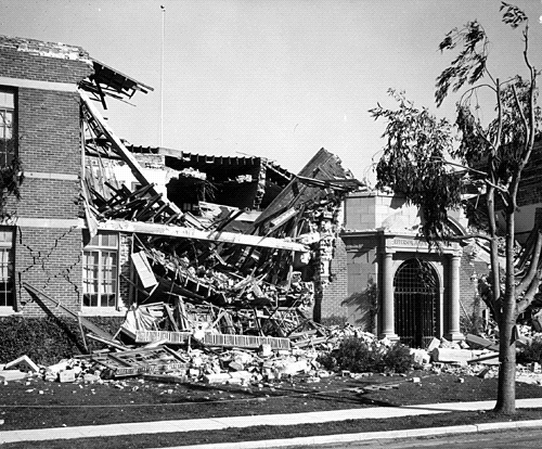
The earthquake was only M6.4, but the deadliest earthquake in Southern California was the March 1933 Long Beach Earthquake, which killed 120 people. Much of the death was due to the brick construction of many buildings in Long Beach and Compton.

 photo Compton.jpg
Compton in the aftermath of the 1933 earthquake. The fallen bricks are what killed many people in this earthquake. Used under a Creative Commons license.

Many schools were badly damaged, but luckily school was out when the earthquake struck at 5:55 p.m. (which should break the myth that big earthquakes only happen in the morning). Had this earthquake occurred just a few hours earlier the death toll would have been much higher with many school children killed.

This thought disturbed and worried a lot of people, and very quickly in April 1933 the state passed The Field Act that mandated earthquake resistant construction for schools.

 photo old_thomas_jefferson_jh.gif
Jefferson Junior High School in Long Beach after the quake. Damage to schools like this throughout the area and what could have been worried parents, teachers and students alike, which led to the passage of The Field Act. Used under a Creative Commons license.

In the 1971 Sylmar Earthquake schools built after The Field Act made it through with no damage while schools built before 1933 suffered major damage.


A newsreel showing the aftermath of the 1933 earthquake.

4 - The 1933 Epicenter Was NOT in Long Beach

The deadly jolt in 1933 will forever be known as The Long Beach Earthquake, but the epicenter was not in Long Beach. Rather, the epicenter was in Newport Beach on The Newport-Inglewood Fault.

While the damage was bad in Long Beach t
he earthquake ended up being the most damaging and deadliest earthquake in Orange County history. Most of the death and destruction was in Santa Ana. However there was also major damage in Garden Grove and Anaheim.

 photo 1933longbeachP061.jpg
Very badly damaged building in Santa Ana. Used under Creative Commons license.

Damage was so bad in downtown Santa Ana that the Santa Ana Register, which was located in downtown Santa Ana, put together their newspaper working outside of their damaged building.
 

Of course this would not be the first time an epicenter would be misidentified. The Sylmar Earthquake was not in Sylmar, but the hills above Sylmar. The Northridge Earthquake was not in Northridge, but in Reseda.

5 - The Christmas Day Earthquake

If you were asleep on Christmas morning in 1899 and felt the house shake you may have thought it was Santa Claus stuck in your chimney trying to wiggle his way out. It was not Santa, but Mother Nature showing that even big earthquakes do not get the holiday off.

At 4:25 a.m. a M6.5 earthquake stuck near San Jacinto on the fault of the same name, The San Jacinto Fault.

This earthquake was felt in a very wide area waking people up in Los Angeles, San Diego and as far as Santa Barbara.

Damage was greatest in San Jacinto and Hemet with many collapsed buildings. In Riverside many chimneys were knocked down and cracks in many buildings appeared. In fact, throughout much of the then sparsely populated Inland Empire the damage reports were much the same along with shattered windows.

The earthquake was deadly at the nearby Soboba Indian Reservation, where six people were killed by falling adobe walls.

In the Earth sciences community there is a little bit of debate if whether this earthquake was larger than M6.5 and just where exactly the epicenter was located. The Southern California Earthquake Center believes the epicenter may have been ten miles south of San Jacinto.

In the end, whether an earthquake hits on Christmas morning or during an imperialistic exploration journey, it is extraordinarily important to be prepared for the next big earthquake.


Monday, March 31, 2014

Top 11 Interesting Southern California Freeways

STUCK ON THE ORANGE CRUSH INTERCHANGE - We would like to think public transportation is finally coming into its own in Southern California, but let us face it, the freeway is still king. For a lot of us the freeway defines our way life, and that is not going to change anytime soon. So, here are the top 11 (some good, some bad) interesting freeways in Southern California.

 photo 6cdc746b2f6f0690b3e89893811a9642.jpg
The Cahuenga Pass once upon a time. Date and author unknown. No copyright infringement intended.

#11 - The Marina Freeway - State Route (SR) 90

Otherwise known as the Westside Wang this has to be one of the most useless freeways in Southern California, and does not seem to serve any real purpose unless you need to get from the Westfield Culver City mall (formerly called Fox Hills Mall) to Marina Del Rey in your Chevrolet right away. 

#10 - The Chino Hills Freeway - SR 71

While driving alongside Chino Hills State Park makes for a nice scenic drive The Chino Hills Freeway is not too sure if it wants to be a freeway, highway or wide boulevard. Adding to the 71's identity crisis is the name, because until somewhat recently it was known as the Corona Expressway, and before that it was called the Temescal Freeway.

#9 - "The 91"

The 91 has one of the worst commutes in the country, because for a few miles through Santa Ana Canyon there are no back roads or alternative routes and thus everybody must take this freeway. Like the 71 this freeway too has bit of an identity crisis. Most people know it as The Riverside Freeway, but between the Interstate 5 and the I-710 interchange it is called The Artesia Freeway, and between the I-710 and I-110 it is called The Gardena Freeway.

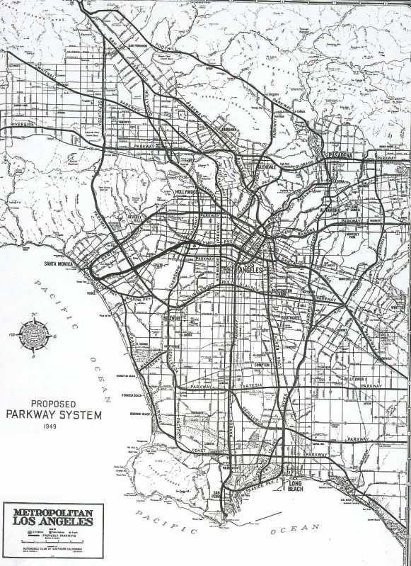
 photo FreewayParkway1947.jpg
The proposed 1947 parkway plan. Photo courtesy of the Southern California Automobile Club. Used under Creative Commons. 

#8 - The Century Freeway - I-105

The last freeway to be competed in the Los Angeles Basin the Century Freeway is a vision of what our freeway system should have been when it was created by adding public transit rail lines along the freeway.

 photo Freeway105-710.jpg
Aerial view of the I-105/I-710 interchange. Date and author unknown; no copyright infringement intended. Used under Creative Commons.

#7 - The Santa Ana Freeway - I-5

The most direct route between L.A. and Orange County embodies everything wrong with post-War Southern California suburban sprawl. While cities and developers were more than happy to build tract-homes and malls for as far as the eye can see the powers that be never saw to it to expand the 5 to accompany the growth until it was way too late.

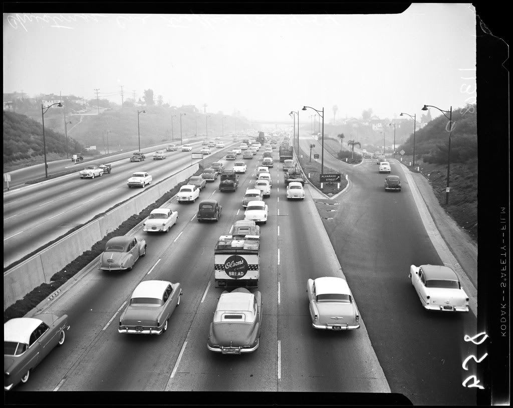
Hollywood Freeway 1954 photo EXM-N-11308-0031.jpg
Not the 5, but a 1954 photograph of The Hollywood Freeway, and although the style of cars have changed the traffic jam remains the same. Used under Creative Commons.

#6 - The Pomona Freeway - SR 60

On those off days when there is little traffic and it is clear and bright the 60 through the San Gabriel Valley actually makes for a nice drive with the green hills to the south of the freeway almost looking like the Pacific Northwest. Yet one cannot help but wonder that it would have made more sense to call the 60 The Riverside Freeway since it connects between downtown Riverside and Downtown L.A.

#5 - The San Gabriel River Freeway - I-605

While it is very convenient for people who live and/or work off the 605, but for an interstate freeway this feels like it does not have any real destination, and that it is kind of just "there," but there is something interesting about this freeway. The 605 goes from the foot of the mountains down to the foot of the ocean, and it is really the only freeway in Southern California that kind of does this.

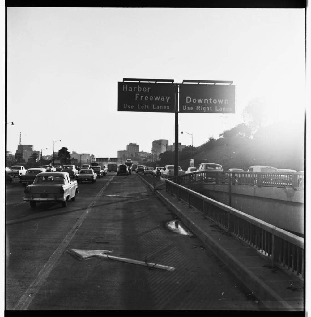
#4 - The Harbor Freeway - I-110

Aside from going through the heart of L.A. the Harbor Freeway offers some of the best views of Downtown L.A.

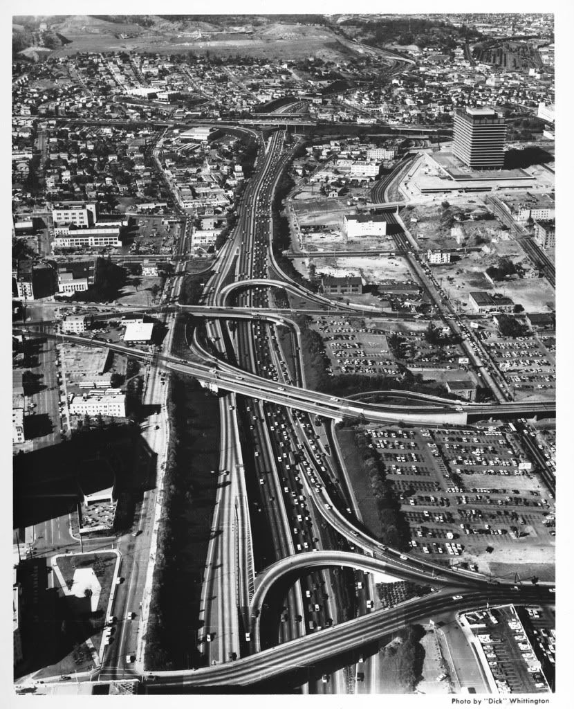
Harbor Freeway 1964 photo DW-46-94-8-ISLA.jpg
The Harbor Freeway through Downtown L.A. in 1964 in a photograph by the great "Dick" Whittington. Used for information purposes; no copyright infringement intended.

#3 - The Glendale Freeway - SR 2

Would not it be ironic if Cal-Trans renamed the 2 The Hipster Freeway given that this freeway goes through some of L.A.'s hip neighborhoods and it is kind of an awkward freeway? That aside The Glendale Freeway southern terminus ends somewhat awkwardly in Echo Park as it is the uncompleted Beverly Hills Freeway. This uncompleted freeway stands as a testament to money and power in L.A. as East L.A. and South L.A. residents were not able to stop massive freeway construction in their neighborhoods, but Hancock Park and Beverly Hills residents waved their magic paper green wands to make this freeway go away. (Interestingly then Governor Ronald Reagan supported completing the 2 to Beverly Hills.)   

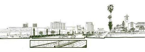
 photo 8136998311_ba0fdc020e.jpg
What could have been, a 1964 drawing of the proposed Beverly Hills Freeway. Photograph courtesy Metro Transportation Library and Archive.


#2 - The I-5 From L.A. to Tijuana

Despite the problems with the 5 it is exciting to think this freeway can take you from Downtown L.A. to another country in (traffic pending) around 90 minutes. How... European.

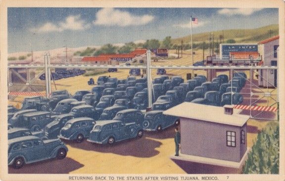
 photo tijuana-border-576x367.jpg
Postcard dated 1945 showing the old border crossing in Tijuana/San Diego.

#1 - The Arroyo Seco Parkway - SR 110

For some people who first experience this freeway, err parkway, it is kind of like a rare fine wine. It kind of takes you by surprise and it takes a moment to settle in, but once it settles in you realize this is one of the most beautiful freeways, excuse me, parkways. in the country. If you have to live life on the freeway The Arroyo Seco Parkway makes it all worth it.

110 Freeway 1961 photo EXM-N-12904-0021.jpgLate 1950s photograph of the Arroyo Seco Parkway. Author unknown. Used under Creative Commons.

Sunday, March 30, 2014

Know Your Faults: Puente Hills Fault

(This is an occasional series exploring the many earthquake fault lines in and around Southern California. This series is not intended to be a scholarly, scientific review of earthquake faults throughout Southern California, but hopefully will be a jumping off point for you to understand and further explore the fault lines that cross Southern California. )   

LA HABRA - It has been a weekend of cleaning up shattered glass, having homes assessed and reassessed to see if they are still livable, and dealing with aftershocks in what is turning out to be perhaps the most damaging earthquake in the Los Angeles Basin since the 1994 Northridge Earthquake.

At only magnitude 5.1 it is considered to be a low-end moderate earthquake, but when you get a typical Southern California shallow quake in the magnitude 5 range under an urbanized area that is when you begin to see damage, and that has been painfully proven for residents and businesses in the Fullerton and La Habra area.

The La Habra quake is bringing much needed attention to something rather unpleasant, the Puente Hills Fault, or otherwise called, the Puente Hills Thrust System.  (For the rest of this piece we shall just call it the Puente Hills Fault.)

How Unpleasant?

Just how unpleasant is the thought of this fault to geologists, seismologists and emergency planners? Well, a major quake, "The Big One," on the San Andreas Fault in Southern California is going to be a major life altering event, but a major earthquake on the Puente Hills Fault, with an expected magnitude 7.2-7.5, could take such a disastrous event to a whole new level. In fact, a major event on this fault is expected to be worse than a major event on the Newport-Inglewood Fault.

Officials at the United States Geological Survey (USGS) believe this La Habra earthquake was caused by the Puente Hills Fault. It is worth noting USGS also believes the 1987 Whittier-Narrows Earthquake, which seismologists originally thought was on the then newly discovered Elysian Park Fault, was also caused by this fault.

Why So Dangerous?

Using rough directions,
the Puente Hills Fault runs about 25 miles, going east-to-west, from about the hills above Brea, across the lower San Gabriel Valley, going northwest into Downtown L.A., and further northwest ending just about before Griffith Park. Seeing and understanding where this fault runs you can understand why a major quake on this fault is such a dreadful thought to officials. 

Now unlike, say, the Whittier Fault or Newport-Inglewood Fault, which has noticeable scars in the earth, like hills, the Puente Hills Fault is a blind thrust fault with no surface scars. 

A Different Kind of Shaking

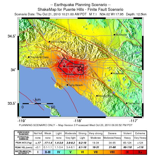
One of the many problems with a major earthquake on this fault is, unlike the Newport-Inglewood Fault or even the San Andreas Fault where those faults are vertical faults resulting in intense shaking near where the fault reaches the surface, the Puente Hills Fault is a horizontal fault with intense shaking felt over a much larger area.

 photo intensity2.jpg 
A shake-map scenario of a M7.1 Puente Hills Fault rupture created by the Southern California Seismic Network at the California Institute of Technology (Caltech) in partnership with USGS. No copyright infringement intended; Shown for educational purposes only.

Just How Bad?

The Southern California Earthquake Center (SCEC) along with the University of Southern California conducted a study in 2003 that showed a major earthquake on the Puente Hills Fault could cause "fatalities ranging between 3,000 and 18,000," along with "displaced households ranging from 142,000 to 735,000, with an average of 274,000."

With a fault running from the lower San Gabriel Valley, into Downtown L.A. up to Griffith Park you would have a major earthquake occurring in Southern California's oldest neighborhoods. Seismologists along with emergency planners believe such a quake could result in severe, catastrophic damage to Downtown L.A.'s older, historic buildings along Broadway, Main Street and Grand Avenue. 

What about the tall, modern skyscrapers that gives L.A. its modern, worldly skyline?

Thomas H. Jordan, director of the SCEC, told the L.A. Downtown News in March 2011 that, “A 7.5 at Puente Hills would pretty much be a worst-case scenario for Downtown,” with shaking lasting more than a minute. Mr. Jordan says, “It’s conceivable that some of the high-rise buildings would collapse [...] A lot of the modern structures in Downtown are very well constructed, so it would take a very extreme event like [a 7.5] to really cause damage to those very well-constructed buildings.”

A major quake could also have a catastrophic affect on the older industrial neighborhoods just southeast of Downtown L.A.

Of course it needs to be noted that this fault crosses over major freeway and freeway interchanges, along with major railway lines and public transit lines. Chances are good that there will be some kind of damage to these lines in the event of a major earthquake.

Some may remember during the Northridge Earthquake railroad tracks actually bent in a few areas.

Of course, there are the fires that will likely break out, and the water-pipes that will burst.

One of the most dreadful worst case scenarios is a major earthquake occurring during the Santa Ana Winds.  

The study predicts total damage cost may come to $250 billion.

While a lot of the focus involving a major earthquake on the Puente Hills Fault has been focused on L.A. it is expected that Orange County will have severe damage with strong ground shaking expected in north Orange County. The M5.1 La Habra earthquake was hardly a dress rehearsal for what is expected in Orange County.


YouTube video created by USGS, SCEC and San Diego Super Computer Center showing the shaking expected from a major Puente Hills Fault earthquake. No copyright infringement intended; shown for educational purposes only. 

Not to be left out the Inland Empire is expected to receive strong shaking and some severe damage, particularly in southwestern San Bernardino County.

So, all around when you get right down to it just how bad will a major Puente Hills Fault earthquake be? Well, there is only really one way to find out, and that is when Mother Nature decides to show us. 

When Will Mother Nature Decide To Let Us Know?

Well, according to USGS researcher Ned Field, the lead author of the SCEC-USC study, a major rupture on the Puente Hills Fault occurs about once every 3,000 years. "In fact," says Mr. Field in the study, "as an individual your odds of dying of a heart attack or an auto accident are much greater than dying from this earthquake." 

If you are like most Southern Californians chances are when you hear that number you probably think there is not anything to worry about, because 3,000 years is a long way away. Well, here is the bad news, geologists and seismologists are not too sure where they are at in the cycle, such as if we are maybe 2,800 years away from the fault rupturing, or one month away from the fault rupturing.

Aside from knowing when the fault ruptures the SCEC-USC study found that the Puente Hills Fault has ruptured at least four times in the last 11,000 years, with earthquakes with magnitudes ranging from 7.2 to 7.5. 

It should be clear by now even if the next major rupture is a couple thousand years away the Puente Hills Fault is going to cause some problems for us in the years to come. 

It is worth noting that in the same March 2011 L.A. Downtown News story Mr. Jordan points out the San Andreas Fault is still a bigger threat to the area, because earthquakes there happen about every 100 to 200 years. 

The last major San Andreas' rupture in our area was the M7.9 1857 Fort Tejon Earthquake, which rupture along 225 miles of the San Andreas Fault beginning near Parkfield and rupturing south to the Cajon Pass.

The last major southern rupture of the San Andreas Fault between the Cajon Pass and the Salton Sea is believed to have occurred around 1690.

Why Does It Seem Like I Am Only Hearing About This Fault Now?

With such a dangerous fault running through Downtown L.A. you think you would of heard all about the Puente Hills Fault growing up or living in Southern California for many years. After all, at one point we have heard all about the San Andreas Fault, Newport-Inglewood Fault, Hollywood Fault, San Jacinto Fault, and Whittier Fault, among many others, but it seems like there has not been a lot said about this extraordinarily dangerous fault. 

You are not alone in thinking and believing you have only recently heard about the Puente Hills Fault, because it was just barely discovered in 1999, and it has taken a few years after that for officials to really understand the danger it poses. 

In the aftermath of the Northridge quake there was urgency among geologists and seismologists to attempt to find blind faults around Southern California.

So Do All These Recent Quakes Mean We're Going To Have a Big Quake?

The recent earthquakes in Orange County and L.A., along with the January 15 M4.4 shaker in Fontana, may simply mean, according to USGS, that Southern California is coming out of its "earthquake drought." 

As Doctor Lucy Jones from USGS has pointed out many times in various media interviews, following the aftermath of the 1994 Northridge Earthquake the L.A. area, aside from the little jolt here and there, has been very seismologically quiet. It seems possible the 1992 Landers/Big Bear earthquakes along with the Northridge quake may have relieved stress for a time in Southern California, but now we may be reentering a seismologically active period in Southern California.

It Could Happen Anytime!

Whether it is preceded by a series of noticeable earthquakes, or no quakes at all, a major earthquake can occur anytime in Southern California. 

We all want a direct answer to the unknowable, and that is WHEN is a major earthquake going to happen? The direct answer to that is this, at this time there is no accurate way to predict earthquakes, and thus there is no way of knowing when a major earthquake is going to occur.

Just Be Prepared!

For a lot of people the above answer is not the one they want to hear, but it is the only answer available. So, all we can do is prepare and have a plan in place when it does happen.

Resources To Help You Prepare

Prepare SoCal from The American Red Cross

Ready L.A. - City of L.A. Emergency Preparedness 

Los Angeles County - Emergency Preparedness

Ready O.C. - Orange County Emergency Preparedness 

San Bernardino County - Emergency Preparedness 

Riverside County Fire Department - Emergency Management

Ready Ventura County - Emergency Management  

San Diego County - Emergency Preparedness

Cal-OES - California Governor's Office of Emergency Services

Tips on Preparing an Emergency Kit from Ready.Gov

Friday, March 7, 2014

Quick Take: Six Odd and Fun Facts About San Bernardino County

COLTON - If you are a regular driver between Southern California and Las Vegas you probably think San Bernardino County is a very large county. Of course you would be right, because that county in the Inland Empire is the largest county within the lower 48 states. Its record was beat with the admission of Alaska as a state, which has a much larger county. Perhaps you knew that already, but here are six odd and fun facts you may not have known about San Bernardino County.

1. The Rolling Stones played their first U.S. concert at the Swing Auditorium in San Bernardino with The Everly Brothers as the opening act.

2. Near where current day Colton is there was once a town called Aqua Mansa, which was, for a time, the largest town between Los Angeles and New Mexico. It is a very significant place with its roots going back to Californio days. Its residents included the Wilson family and family member Don Benito Wilson. That Mr. Wilson is better known as Benjamin David Wilson who would go on to be the second elected Mayor of L.A., and whom Mount Wilson is named after.

3. Future Vice-President and President Lyndon B. Johnson once worked as an elevator operator at a San Bernardino building in 1925. During a 1964 reelection campaign stop in San Bernardino LBJ returned to that building, known as the Platt Building, to operate the elevator once more in front of a few cameras. 

 photo PlattBldg_web.jpg
Platt Building in San Bernardino. Date and photograph author unknown. No copyright infringement intended; shown for educational and historic purposes only. 

4. The oldest Jewish cemetery in Southern California is in San Bernardino.

5. The last two magnitude 7-plus earthquakes in California were in San Bernardino County. Those quakes are, the 1992 Landers Earthquake and the 1999 Hector Mine Earthquake

6. The San Bernardino Sun has been for many decades, and continues to be, the dominate newspaper in the San Bernardino area. Back in the 1960s the Los Angeles Times' then parent company Times-Mirror made an attempt to buy The Sun, but federal government antitrust officials were not too keen on the idea and thus no sale. Today The Sun is apart of the Los Angeles Newspaper Group, which includes, the L.A. Daily News, and Daily Bulletin, Pasadena Star-News, among other Southern California newspapers.

Tuesday, February 4, 2014

Go To This: See Big Boy in Colton

COLTON - There was a time in American history not too long ago when big, massive locomotives pouring out massive thick dark smoke ruled the rails. Some of these locomotives are what built part of Southern California (sometimes in nefarious ways), and perhaps more than a few people remember when they can hear and see the big smoking locomotive rolling down the tracks. 

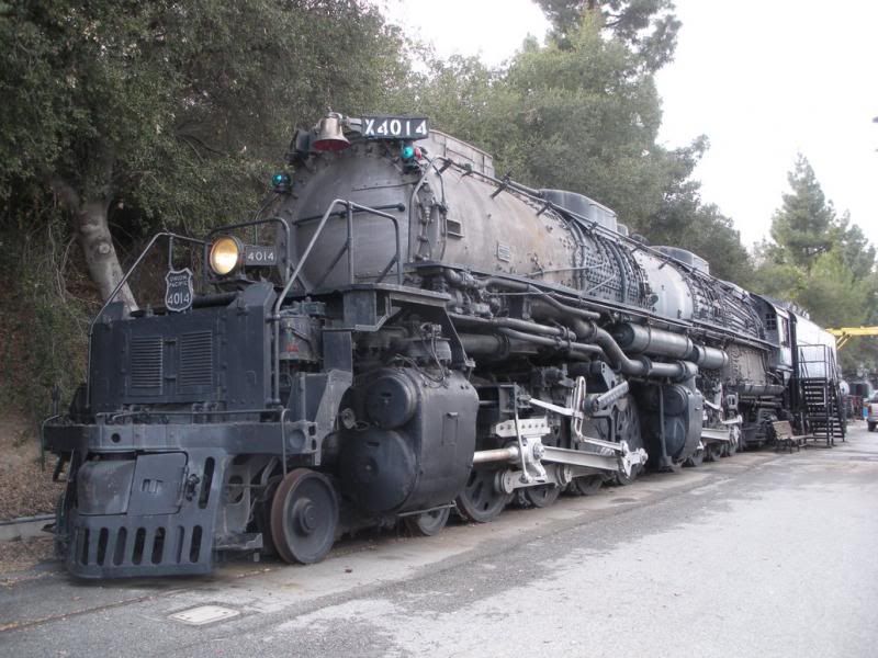
Among these massive trains that once ruled the rails were Union Pacific No. 4014, otherwise known as Big Boy, and before it leaves Southern California you have one last chance to see it.

 photo 
union_pacific_big_boy_4014_in_pomona_by_rlkitterman-d4pf5bp.jpg

Union Pacific No 4014 Big Boy on Display in Pomona. No copyright infringement intended; shown for historical and educational purposes only.

Yes, it is bad news is a historic piece of history is leaving Southern California, but unlike many historic things that have left us forever there is actual good news here.

In January for the first time in nearly 52 years the wheels on Big Boy turned again and the big old locomotive was back on the tracks as Big Boy will be headed to Union Pacific's Heritage Fleet Operations in Cheyenne, Wyoming from Pomona, with a side stop in Colton, to be restored and soon put back into service for nostalgia trips.

Just how big was Big Boy? According to Union Pacific:

Twenty-five Big Boys were built exclusively for Union Pacific Railroad, the first of which was delivered in 1941. The locomotives were 132 feet long and weighed 1.2 million pounds. Because of their great length, the frames of the Big Boys were "hinged," or articulated, to allow them to negotiate curves. They had a 4-8-8-4 wheel arrangement, which meant they had four wheels on the leading set of "pilot" wheels which guided the engine, eight drivers, another set of eight drivers, and four wheels following which supported the rear of the locomotive. The massive engines normally operated between Ogden, Utah, and Cheyenne, Wyo.

The Big Boy was in service from 1941 until 1959, and found new life in 1962 being the centerpiece of the RailGiants Train Museum at the Fairplex in Pomona.

If you never had a chance to see the Big Boy while it was in Pomona, well, this weekend it is highly suggested you make the drive out to Colton, because you will have one last chance to see the famed Union Pacific locomotive.

If you miss seeing the big train in Colton you will have to wait awhile, because after this weekend the locomotive will make its slow, but steady trip to Cheyenne to be restored, and Union Pacific officials believe the restoration process will take about five years.

Big Boy will be on display from 9 a.m. to 4 p.m. at the Union Pacific’s Colton Yard this Saturday and Sunday. 

To find the Big Boy go here: 
Union Pacific Bloomington entrance 
19100 Slover Avenue (Roughly between Cedar Ave. and Riverside Ave.)
Bloomington, CA
92316


Friday, January 17, 2014

Remember the Last (Slightly) Damaging Earthquake in L.A.?

LOS ANGELES - Remember the last earthquake that did any sort of damage in Los Angeles? It is not the one you are probably thinking about.

On this 20th anniversary of the Northridge Earthquake many people are sharing the stories of where they were the the ground wobbled like mad at 4:31 a.m. Unsurprisingly the common answer to the question of, "Where were you with the earthquake happen?" is, "I was in my bed sleeping."

If you were to ask when was the last damaging earthquake in L.A. you would likely be told it was the 1994 disaster with good reason, but, as we look over L.A.'s very recent earthquake past over the last ten years, there was a much less damaging earthquake in L.A. seven years later.

Though it was not a very big jolt it was the first earthquake after Northridge to cause any sort of damage in L.A. proper, and the largest earthquake to occur in the L.A. basin since the Northridge Earthquake and its aftershocks. Like many typical "garden variety" jolts before it this quake was quickly forgotten, but given the date this particular earthquake occurred this shaker was probably thrown down the memory hole quicker than usual.

On September 9, 2001 a magnitude 4.2 earthquake occurred in West Hollywood at 4:59 p.m., and as Dr. Egill Hauksson and Dr. Kate Hutton at the California Institution of Technology, along with Dr. Lucy Jones of the United States Geological Survey report, this earthquake may have be associated with the north end of the Newport-Inglewood Fault, which was the cause of the 1933 Long Beach Earthquake.

Of course with an earthquake of this size you would not expect any sort of major damage, and there was no major damage. However one window in the West L.A. area shattered, but luckily nobody was hurt. As well there were dishes that broke and items that flew off the shelves.

As you see the date of this quake no doubt just two days later this jolt would be all but forgotten. A quake of this size under a very populated area is always enough to get the nerves up, and it is interesting to think what the reaction would have been had this M4.2 quake occurred two days later on September 11, 2001, or frankly just anytime later that week.  

After that the next real notable shaker in L.A. proper would not be until nearly eight years later on May 17, 2009, which a M4.7 with an epicenter about 3 miles east of Los Angeles International Airport occurred at 8:39 p.m., otherwise called the Inglewood Earthquake. This quake was felt by a lot of people throughout Southern California, including Ventura and San Diego Counties, and had the type of damage you would expect from this kind of jolt, such as items falling off shelves. One window of a business was reportedly shattered in Long Beach. Like the West Hollywood shock in 2001 seismologists believe this too was an act of the Newport-Inglewood Fault.  

Now the last real damaging earthquake of any sort in Southern California was the 2008 M5.4 Chino Hills Earthquake, which caused a lot of property damage in the western Inland Empire and Pomona Valley areas. This was also the last magnitude 5-plus earthquake to occur in the metro L.A. area.

The last earthquake of magnitude 7-plus to hit the general region was the M7.2 2010 Sierra El Mayor Earthquake located south of Mexicali in Baja California, Mexico and felt throughout much of Southern California on Easter Day. 

It should be noted that the last magnitude 7 earthquake in Southern California was the M7.1 1999 Hector Mine Earthquake, which, luckily, had an epicenter in the rural San Bernardino County desert about 47 miles east-southeast of Barstow.

It has been said that L.A. and Southern California has been lucky no major earthquake has occurred right under its populated areas in 20 years, but if you spend any time at the gambling tables in Las Vegas you know luck has a way of running out sooner rather than later.

So on this anniversary take the time and prepare yourself for the next disaster.